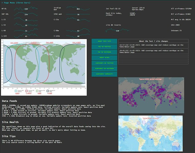
After some solid feedback from a few OSINT folk on Twitter, I cut down drastically the amount of wordage and added three images and a few buttons.
On the left is the map of the three main Inmarsat’s that we pickup. (Four if you count L-54w).
Note also at the bottom of the map is the ‘-143w’, that is there so you can see what to search via any of the three site search pages if you want all messages just from that one area.
If you just want to see aircraft messages search for C-143w if you just want to see uplink messages (say, mission codes), then search for L-143.
In the middle we have a few link buttons for some ways to find out more about the site and ACARS.
On the top right, the usual table with the last 7 updates to the site.
Next is the typical ADSC map. This is the ‘planes on a map’ feed that many love. (Don’t get me started).
Below that is the current Iridium coverage map (roughly, the blobs move around a bit).
Hopefully that helps everyone get a better quick feel for what the site covers and how it is possible to tap into the ACARS messages from each of those sources.
